Heat wave in Europe: 30°C in Scandinavia, 38-40°C in Sardinia and Sicily, 35-38°C in central, eastern Europe and the Balkans, but significant temperature drop and severe thunderstorms are coming

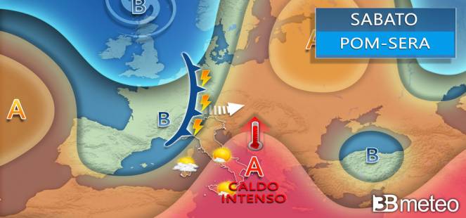
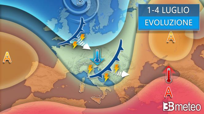
A wide high pressure system is dominating much of Europe bringing warm air masses to Scandinavia, resulting in temperatures 8-10°C above average or locally more in some countries like Scandinavia and central/central-eastern Europe. All is going to change, over the next few days from the western Europe to the eastern and mostly from Monday, as a low pressure system will bring cloud increase, showers, severe thunderstorms with local hail, followed by a significant temperature drop as cold air masses are arriving.

30°C in Scandinavia, 38-40°C in Sardinia and Sicily, 35-38°C in central and eastern Europe and in the Balkans: During the last 3 days extreme high temperatures are experiencing in Scandinavia with maximum temperatures reaching 28-30°C in the southern parts or locally over especially under the sunny conditions with many people finding a get away in the beaches, while a temperature drop in expected from tomorrow. Not only Scandinavia, but also Spain reached temperatures 36-38°C earlier this week, while France reached 33-35°C locally the last 2 days. In Italy today maximum temperatures reached 38-40°C and especially in Sardinia and Sicily, while temperatures will continue to be high during the weekend. Regarding central and eastern Europe and the Balkans, today and during this weekend temperatures will continue to be really high across central and eastern Europe and the Balkans with maximum temperatures reaching locally 35-38°C.

Thunderstorms locally severe and significant temperature drop are coming from the west: A low pressure system in Spain will move northeastwards towards France and central Europe tomorrow, while on Sunday it will continue its path towards northeastern Europe. The system will bring scattered showers and thunderstorms, locally severe with hail, especially between eastern France, Germany, the Alps and northern Italy. A new low pressure system will follow on the first days of July bringing new thunderstorms across the Mediterranean countries and the Balkans. The systems will be accompanied by cold air masses in the upper atmosphere which will bring a significant temperature drop in much of Europe, starting from tomorrow from the western Europe and moving eastwards to central and eastern Europe, resulting in an even 10°C temperature difference in the maximum temperatures. In more detail, during the first days of July maximum temperatures will be around 18-23°C in much of western, central and northeastern Europe (exception is Spain, Balkans, southern Italy and far eastern Europe), while this week were reaching 34-37°C. Temperatures will be 4-6°C below average with the biggest temperature difference experiencing northwestern Europe and especially France, Germany and Scandinavia.
